This property is not currently listed for rent.
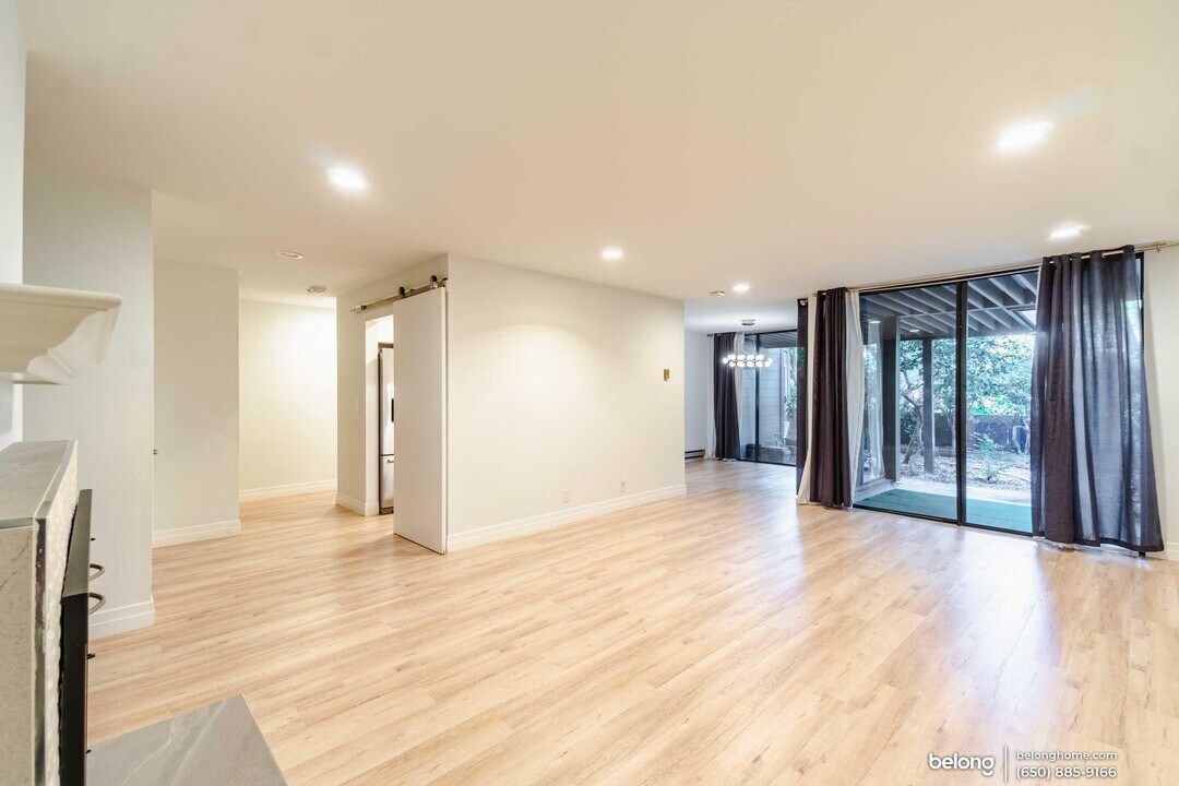
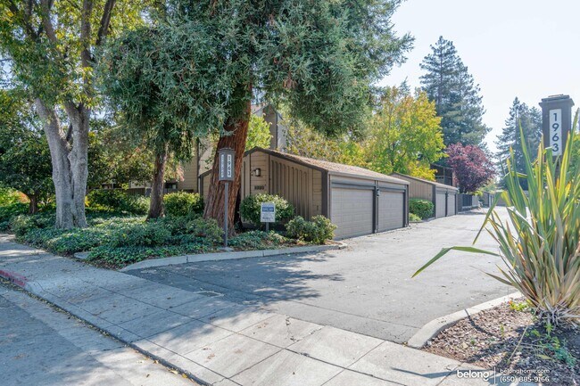
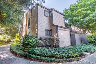
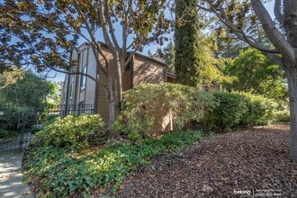
Photos


Map
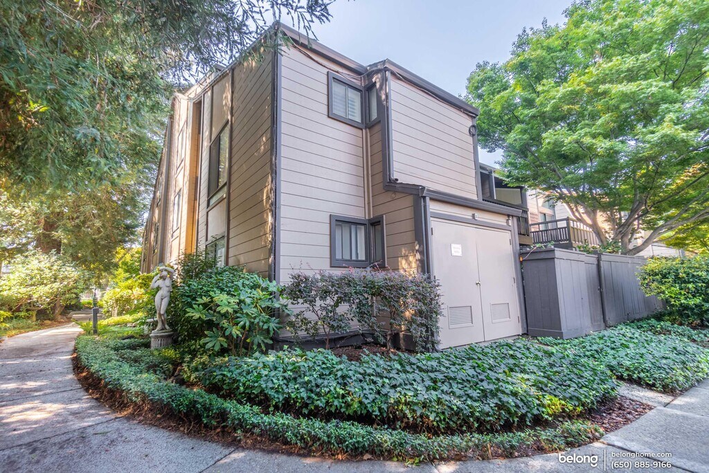
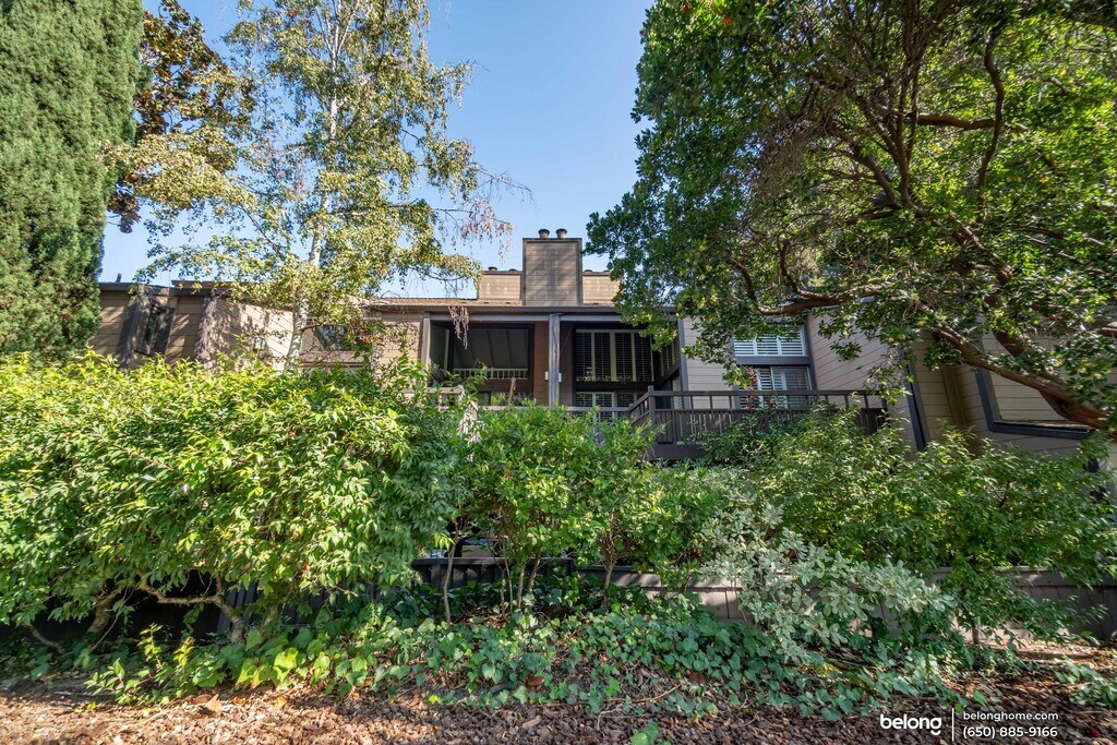
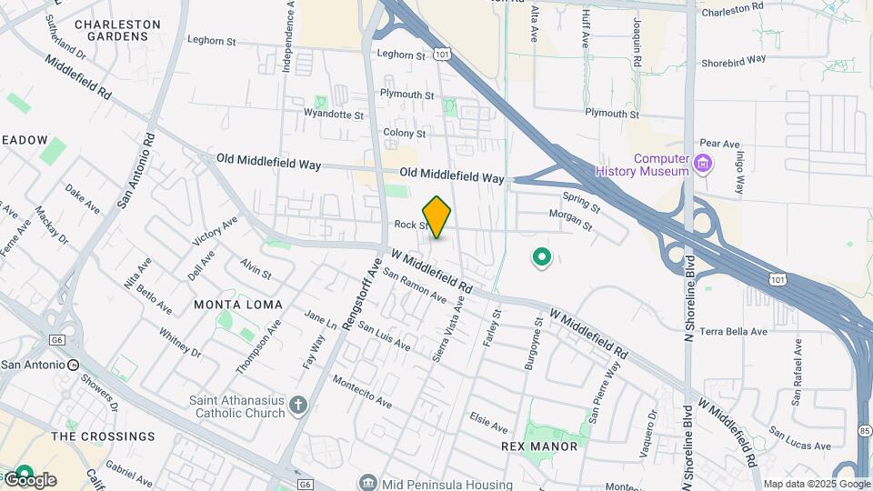
1963 Rock St, Mountain View, CA 94043
- Shopping
- Colleges
- Schools
- Grocery
- Medical
- Parks
- Transportation
Map
Points of Interest
Time and distance from 1963 Rock St.
Big Box and Retail
Michaels
2415 Charleston Rd
2 minute drive / 0.87 miles away
Petsmart
2440 Charleston Rd
2 minute drive / 0.95 miles away
Walmart
600 Showers Dr
3 minute drive / 1.26 miles away
Colleges and Universities
Groceries
Trader Joe's
570-590 Showers Dr
3 minute drive / 1.26 miles away
Safeway
645 San Antonio Rd
3 minute drive / 1.33 miles away
Whole Foods
4800 El Camino Real
4 minute drive / 1.36 miles away
Hospitals
Lucile Salter Packard Children's Hospital At Stanford
725 Welch Road
10 minute drive / 5.04 miles away
Military Bases
Ames Research Center
5 minute drive / 1.8 miles away
Army National Guard San Jose
22 minute drive / 10.73 miles away
Parks and Recreation
1963 Rock St has 1 park within 10.6 miles, including Rosicrucian Park.
Shopping Centers
1963 Rock St has 5 shopping centers within 0.7 miles.
Transit Stations
San Antonio-Caltrain
2 minute drive / 0.97 miles away
Mountain View Station-Mountain View - Winchester Line
600 W. Evelyn Ave, Mountain View, CA
3 minute drive / 1.25 miles away
Mountain View-Caltrain
4 minute drive / 1.34 miles away
Nearby Neighborhoods
Rental Price Ranges in the Area
| Bedroom | Average Rent | Cheapest Rent | Highest Rent |
|---|---|---|---|
| Mountain View Studio Apartments | $2,721 | $1,200 | $4,160 |
| Mountain View 1 Bedroom Apartments | $3,797 | $1,185 | $9,151 |
| Mountain View 2 Bedroom Apartments | $4,774 | $2,303 | $10,000+ |
| Mountain View 3 Bedroom Apartments | $5,568 | $2,650 | $9,955 |
Nearby Apartments
Nearby Homes
Protect yourself from fraud. Avoid Scams and Fraud
Did You Know?
Apartment residents stay an average of 2.5 years in their apartment before moving.