
Unit SI ID1249863P
- 4BR, 2BA
- $5,463 Pricing
- 2,260 Square Feet
- Available Soon Availability
Unit SI ID1249863P Rent and Fees
Unit Price
- $5,463
About 630 E 300 S
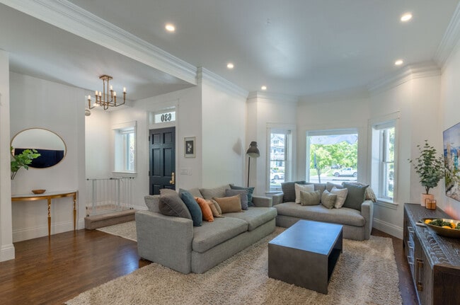
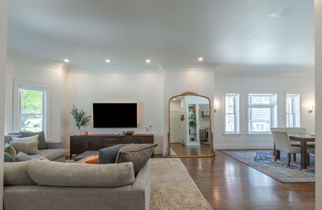
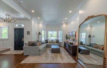
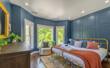
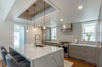
The advertised rate of $5,464/month is the lowest available price, based on a 1 month(s) stay with a move-in date of June 24, 2026. Rates vary depending on the duration of stay, season, and other parameters. For exact pricing and additional pricing components, please visit our website and enter your desired move-in and move-out dates. The rate is applicable when billed upfront; it can be higher if billed in multiple payments. Feel at home in this spacious and character-filled 4-bedroom Victorian home in Salt Lake City, offering a comfortable and fully furnished base for your stay. This historic home features hardwood floors throughout, large windows, and a bright interior. The fully equipped kitchen includes stainless steel appliances. Enjoy spacious living and dining areas, a private patio, and a private hot tub. This property is pet-friendly and includes an EV charger and garage parking for up to 4 vehicles, with 2 garage stalls. Early check-in and late check-out may be available for a fee. Located in a walkable neighborhood near Downtown Salt Lake City, this home offers convenient city access. It's just 1 block from the TRAX Red Line, providing direct access to Downtown Salt Lake City, Rice-Eccles Stadium, Delta Center, Eccles Theater, Temple Square, and Salt Lake City International Airport. Nearby outdoor recreation includes Liberty Park, Bonneville Shoreline Trail, and the Avenues Foothills. As with many homes of this era, some layout features reflect the home’s historic design. This is a 100% smoke-free property; any violation will result in a $200 per day fine. Undisclosed or unauthorized pets will incur a $250 fee, and approved pets incur a monthly pet fee. Guests are responsible for cleaning up after their pets, with a $25 fee per instance of uncollected waste outdoors and responsibility for professional cleaning costs for indoor "accidents" and any property damage caused by pets. Unauthorized late check-outs will be charged a fee. Quiet hours begin at 10:00 PM each night and continue until 8:00 AM each morning. Moving furniture is not allowed and will result in a $500 fee if cleaners have to move furniture to reset the property for the next guest. Garbage must be bagged and stowed in the bins; a $50 fee, per bin, will be assessed for unbagged garbage found in the bins. The home is comfortably set up for remote work, featuring a dedicated workspace and fast Wi-Fi. [SI]
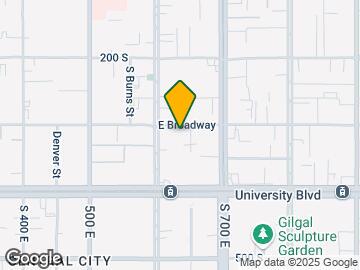
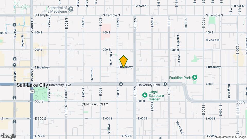
630 E 300 S is located in the Central Salt Lake City Neighborhood and 84102 Zip code of Salt Lake City, UT.
Property Contact Info
- Listed by:
- Agency:
- Vendor Logo:
- Website:
- View Property Website
- Call Us:
- (972) 289-8633
- Disclaimer:
Property Information
- Furnished
Lease Terms
- 1
- Short Term Lease Options
Fees and Policies
Pet Policy and Fees
Cats
AllowedDogs
AllowedParking Info and Fees
- Covered
Property Fee Disclaimer: Based on community-supplied data and independent market research. Subject to change without notice. May exclude fees for mandatory or optional services and usage-based utilities.
Features and Amenities
Unique Amenities
- SharedYard
On-Site Services
- Garden
Community Features
- Corporate Suites
Recreation and Fitness
- Spa
Interior Features
- Balcony
- Heating
- Washer/Dryer
- Air Conditioning
- Wi Fi
Kitchen Amenities
- Oven
- Refrigerator
- Freezer
- Kitchen
- Dishwasher
- Microwave
Map
- Shopping
- Colleges
- Schools
- Grocery
- Medical
- Parks
- Transportation
Map
Frequently Asked Questions about 630 E 300 S
What type of rentals are available at 630 E 300 S?
There is currently a 4 Bed 2 Bath Apartment for rent with 2,260 listed at 630 E 300 S. It is Available Soon .
How much is the rent at 630 E 300 S?
630 E 300 S is currently listed at $5,463.
What area of town is 630 E 300 S located in?
Located in the Central Salt Lake City Neighborhood, 630 E 300 S is in the 84102 Zip Code of Salt Lake City, UT.
Points of Interest
Time and distance from 630 E 300 S.
Big Box and Retail
Walgreens
Lowe's
Target
Colleges and Universities
Groceries
Natural Grocers
Whole Foods
Hospitals
Salt Lake Regional Medical Center
Lds Hospital
Shriners Children's Salt Lake City
Military Bases
Douglas Army Reserve Center
Salt Lake City Airport Air Guard Station
Parks and Recreation
630 E 300 S has 5 parks within 8.6 miles, including Liberty Park, Pioneer Park, Red Butte Garden and Arboretum, Sugar House Park, and Wheeler Historic Park.
Shopping Centers
630 E 300 S has 5 shopping centers within 0.3 miles.
Transit Stations
Nearby Neighborhoods
Nearby Apartments
Rental Price Ranges in the Area
| Bedroom | Average Rent | Cheapest Rent | Highest Rent |
|---|---|---|---|
| Salt Lake City Studio Apartments | $1,363 | $483 | $2,666 |
| Salt Lake City 1 Bedroom Apartments | $1,657 | $500 | $9,417 |
| Salt Lake City 2 Bedroom Apartments | $2,089 | $1,008 | $10,000+ |
| Salt Lake City 3 Bedroom Apartments | $2,472 | $1,100 | $10,000+ |
| Salt Lake City 4 Bedroom Apartments | $2,838 | $1,304 | $6,283 |
Browse Top Apartments in Salt Lake City
By Price
- Cheap Salt Lake City Apartments
- Salt Lake City Apartments Under $500
- Salt Lake City Apartments Under $700
- Salt Lake City Apartments Under $800
- Salt Lake City Apartments Under $900
- Salt Lake City Apartments Under $1000
- Salt Lake City Apartments Under $1200
- Salt Lake City Apartments Under $1500
- Salt Lake City Apartments Under $2000
- Salt Lake City Luxury Apartments
By Community Type
- Salt Lake City Apartments for Rent by Owner
- Salt Lake City Apartments with Rent Specials
- Salt Lake City Top Rated Apartments
- Salt Lake City Corporate Apartments
- Salt Lake City Furnished Apartments
- Salt Lake City Gated Apartments
- Salt Lake City Loft Apartments
- Salt Lake City Low Income Apartments
- New Salt Lake City Apartments
- Salt Lake City Senior Apartments
- Salt Lake City Short-term Apartments
- Salt Lake City Student Apartments
- Salt Lake City Apartments with Utilities Included
By Amenities
- Salt Lake City Apartments with Hardwood Floors
- Salt Lake City Apartments with Laundry Rooms
- Salt Lake City Apartments with Parking
- Salt Lake City Pet Friendly Apartments
- Salt Lake City Apartments with Swimming Pool
- Salt Lake City Apartments with Washer/Dryer
- Salt Lake City Apartments with EV Charging