
- 3BR, 2BA Home
- $2,749 Pricing
- 1,257 Square Feet
- Available Now Availability
Unit Rent and Fees
Unit Price
- $2,749
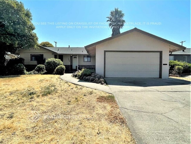
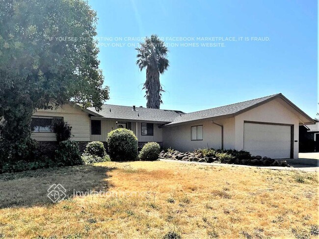
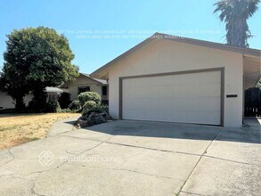
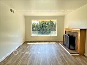
About 7030 Tamoshanter Way
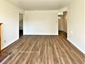
Lease this home and get more from Invitation Homes professional property management. This home comes fully loaded with quality amenities, must-have services, high-end tech and ProCare® professional maintenance. Your estimated total monthly payment is $2892.30. That covers your base rent, $2749.00 + our required services designed to make your life easier: Air Filter Delivery Fee ($9.95), Internet & Media ($85), Smart Home with video doorbell ($40), and Utility Billing Service Fee ($8.35). Base rent varies based on selected lease term. Currently being refreshed by Invitation Homes. This home is sure to wow with luxury upgrades like stainless steel appliances, premium cabinets, granite countertops, stylish recessed lighting in the kitchen, and bathroom light fixture installations. This convenient layout makes it easy to cook, entertain, or relax when you need a break. There are so many ways to take advantage of this lovely home. Please note the photos above reflect the current state of the home and do not yet include these improvements. Apply online today or reach out to your Invitation Homes Leasing Experience Specialist for more information! This home is located within the service area where our Internet Package is required, it will be equipped with high-speed internet and media streaming capabilities at just $85 per month, a great value. This monthly fee will be required in your lease. California residents: Please contact your leasing professional to opt out of the Invitation Homes Internet Package. At Invitation Homes, we offer pet-friendly, yard-having homes for lease with Smart Home technology in awesome neighborhoods across the country. Live in a great house without the headache and long-term commitment of owning. Discover your dream home with Invitation Homes. Our Lease Easy bundle – which includes Smart Home, Air Filter Delivery, and Utilities Management – is a key part of your worry-free leasing lifestyle. These services are required by your lease at an additional monthly cost. Monthly fees for pets and pools may also apply. Home Features and Amenities: Fenced Yard, Garage, Granite Countertops, Long Lease Terms, Luxury Vinyl Plank, Patio, Pet Friendly, Recessed Lighting, Smart Home, Stainless Steel Appliances, W/D Hookups, and professionally managed by Invitation Homes. This Invitation Home is currently being renovated, but it will be available soon. You can still apply – contact us for more details or apply now. Invitation Homes is an equal housing lessor under the FHA. Applicable local, state and federal laws may apply. Additional terms and conditions apply. This listing is not an offer to rent. You must submit additional information including an application to rent and an application fee. All leasing information is believed to be accurate, but changes may have occurred since photographs were taken and square footage is estimated. See InvitationHomes website for more information. Beware of scams: Employees of Invitation Homes will never ask you for your username and password. Invitation Homes does not advertise on Craigslist, Social Serve, etc. We own our homes; there are no private owners. All funds to lease with Invitation Homes are paid directly through our website, never through wire transfer or payment app like Zelle, Pay Pal, or Cash App. For more info, please submit an inquiry for this home. Applications are subject to our qualification requirements. Additional terms and conditions apply. CONSENT TO CALLS & TEXT MESSAGING: By entering your contact information, you expressly consent to receive emails, calls, and text messages from Invitation Homes including by autodialer, prerecorded or artificial voice and including marketing communications. Msg & Data rates may apply. You also agree to our Terms of Use and our Privacy Policy.
7030 Tamoshanter Way is located in the Golf Course Terrace Neighborhood and 95822 Zip code of Sacramento, CA.
Property Contact Info
- Listed by:
- Agency:
- Vendor Logo:
- Website:
- View Property Website
- Call Us:
- (888) 990-4684
- Disclaimer:
Fees and Policies
The fees listed below are community-provided and may exclude utilities or add-ons. All payments are made directly to the property and are non-refundable unless otherwise specified.
Required Fees
Utilities
- Smart Home with video doorbelliCharged per unit.$40/mo
- Utility Billing Service FeeiCharged per unit.$8.35/mo
- Air Filter Delivery FeeiCharged per unit.$9.95/mo
- Internet & MediaiCharged per unit.$85/mo
Pet Policy and Fees
Cats
AllowedDogs
AllowedParking Info and Fees
- Garage Parking
Property Fee Disclaimer: Based on community-supplied data and independent market research. Subject to change without notice. May exclude fees for mandatory or optional services and usage-based utilities.
Features and Amenities
On-Site Services
- Garden Style
Outdoor Features
- Fenced Lot
- Patio
Unique Amenities
- Garage Available

Map
- Shopping
- Colleges
- Schools
- Grocery
- Medical
- Parks
- Transportation

Map
Frequently Asked Questions about 7030 Tamoshanter Way
What type of rental is available at 7030 Tamoshanter Way?
There is currently a 3 Bed 2 Bath Home for rent with 1,257 sq ft listed at 7030 Tamoshanter Way. It is Available Now.
How much is the rent at 7030 Tamoshanter Way?
The rental at 7030 Tamoshanter Way is currently listed at $2,749.
What area of town is 7030 Tamoshanter Way located in?
Located in the Golf Course Terrace Neighborhood, 7030 Tamoshanter Way is in the 95822 Zip Code of Sacramento, CA.
Points of Interest
Time and distance from 7030 Tamoshanter Way.
Big Box and Retail
Walgreens
Staples
Walmart
Colleges and Universities
Groceries
Smart & Final
Raley's
Nugget Markets
Hospitals
University Of California Davis Medical Center
Military Bases
National Guard Armory Sacramento
Parks and Recreation
7030 Tamoshanter Way has 5 parks within 5.9 miles, including Southside Park, Sutter's Fort State Historical Park, Capitol Park, Paradise Beach, and Sutter's Landing Regional Park.
Shopping Centers
7030 Tamoshanter Way has 5 shopping centers within 1.4 miles.
Transit Stations
Nearby Neighborhoods
Nearby Apartments
Rental Price Ranges in the Area
| Bedroom | Average Rent | Cheapest Rent | Highest Rent |
|---|---|---|---|
| Sacramento Studio Apartments | $1,695 | $957 | $3,550 |
| Sacramento 1 Bedroom Apartments | $1,827 | $587 | $10,000+ |
| Sacramento 2 Bedroom Apartments | $2,133 | $575 | $6,993 |
| Sacramento 3 Bedroom Apartments | $2,702 | $755 | $6,986 |
| Sacramento 4 Bedroom Apartments | $1,430 | $599 | $6,921 |
Browse Top Apartments in Sacramento
By Price
- Cheap Sacramento Apartments
- Sacramento Apartments Under $600
- Sacramento Apartments Under $700
- Sacramento Apartments Under $800
- Sacramento Apartments Under $900
- Sacramento Apartments Under $1000
- Sacramento Apartments Under $1200
- Sacramento Apartments Under $1500
- Sacramento Apartments Under $2000
- Sacramento Luxury Apartments
By Community Type
- Sacramento Apartments for Rent by Owner
- Sacramento Apartments with Rent Specials
- Sacramento Top Rated Apartments
- Sacramento Corporate Apartments
- Sacramento Furnished Apartments
- Sacramento Gated Apartments
- Sacramento Loft Apartments
- Sacramento Low Income Apartments
- Sacramento Military Apartments
- New Sacramento Apartments
- Sacramento Senior Apartments
- Sacramento Short-term Apartments
- Sacramento Student Apartments
- Sacramento Apartments with Utilities Included