
- 3BR, 2BA Home
- $1,995 Pricing
- 1,926 Square Feet
- 09-03-2026 Availability
Unit Rent and Fees
Unit Price
- $1,995
Deposit
- $1,995 deposit
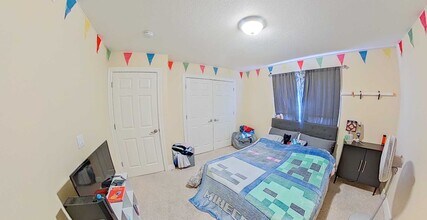
About 601 Harland Dr
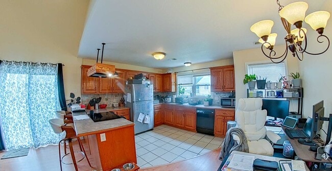
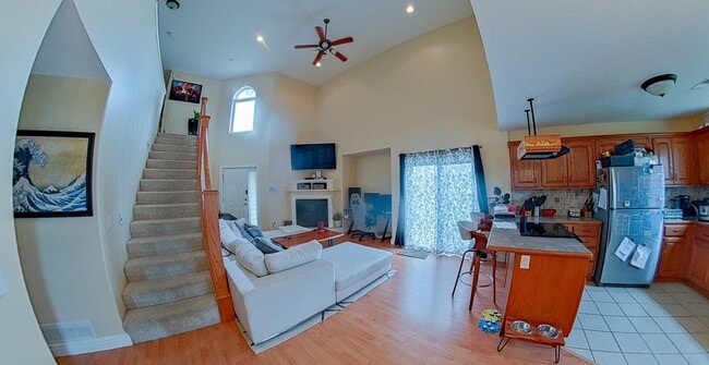
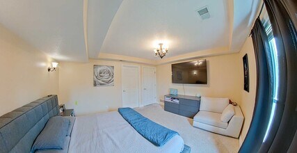
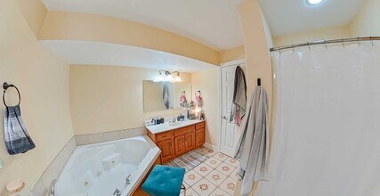
This town home is located in the new Highland Meadows development on the west side of Manhattan, right off Scenic Drive. The main floor of this 2 story home has a 2-car garage, laundry room, kitchen, dining area with sliding door to the yard, 17' tall ceilings in the greatroom, beautiful gas fireplace, and a large main floor Primary Suite with private full bathroom with a soaker tub and separate shower, as well as a walk-in closet. The loft-style second floor consists of two 12' x 12' bedrooms, each with ample closet space, the second full bathroom, and a storage room. *Trash is billed to your online portal at a discounted rate of $27/ month. You do not need to put trash service in your name. *NO CO-SIGNERS allowed per owners policy. *Rent-a-fence is on a month-to-month lease with 2 weeks notice for removal. Hate pests? So do we! This property has free, around the clock total pest control coverage, so pests will never be a concern for you or your wallet! ****This property is managed by the top-rated Property Management team in the Manhattan area. For the most current and updated availability and pricing please visit our current listing page at AmericanMHK online where you can set up a showing on your own, hassle-free, just pick the time that works best for you and you're all done! We love taking care of our residents! We have more than just the property you are looking at now. Please feel free to call our office at and talk with a leasing specialist today to find the home for you or to schedule a tour of homes. Our residents love us because…. -24 Hour Professional Maintenance -98% of work orders responded to in less than 12 hours. -Online & Mobile monthly rent payments made easy- We accept E-check and Credit card online Come see the difference at American Property Management!
601 Harland Dr is located in the 66503 Zip code of Manhattan, KS.
Unique Features and Amenities
- Garage Parking
- Gas Fireplace
- Laminate Wood Plank Flooring
- No Utilities Included
- Vaulted Ceiling
- Washer-Dryer Hookups
Property Contact Info
- Listed by:
- Agency:
- Vendor Logo:
- Website:
- View Property Website
- Call Us:
- (785) 236-1988
- Disclaimer:
Fees and Policies
The fees listed below are community-provided and may exclude utilities or add-ons. All payments are made directly to the property and are non-refundable unless otherwise specified.
Required Fees
One-Time Basics
- Due at Move-In
- Security Deposit - RefundableiCharged Per Unit.$1995
Pet Policy and Fees
Cats
AllowedDogs
AllowedProperty Fee Disclaimer: Based on community-supplied data and independent market research. Subject to change without notice. May exclude fees for mandatory or optional services and usage-based utilities.
Features and Amenities
Unique Amenities
- Garage Parking
- Gas Fireplace
- Laminate Wood Plank Flooring
- No Utilities Included
- Vaulted Ceiling
- Washer-Dryer Hookups
On-Site Services
- Garden Style
Kitchen Amenities
- Range
- Refrigerator
- Dishwasher
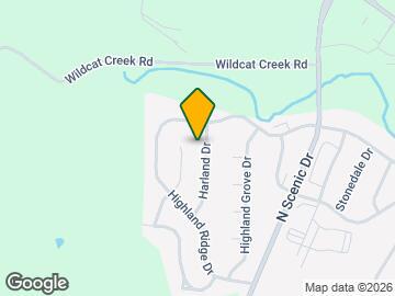
Map
- Shopping
- Colleges
- Grocery
- Medical
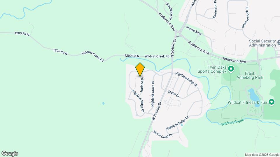
Map
Frequently Asked Questions about 601 Harland Dr
What type of rental is available at 601 Harland Dr?
There is currently a 3 Bed 2 Bath Home for rent with 1,926 sq ft listed at 601 Harland Dr. It is Available September 3, 2026.
How much is the rent at 601 Harland Dr?
The rental at 601 Harland Dr is currently listed at $1,995.
What area of town is 601 Harland Dr located in?
601 Harland Dr is in the 66503 Zip Code of Manhattan, KS.
Nearby Schools
Riley County High School
Riley County Grade School
About GreatSchools Data on ApartmentHomeLiving.com.
Points of Interest
Time and distance from 601 Harland Dr.
Big Box and Retail
Walgreens
Target
Petsmart
Colleges and Universities
Kansas State University - Manhattan Campus
Groceries
Dillons
Aldi
Food-4-Less
Hospitals
Manhattan Surgical Hospital
Mercy Regional Health Center
Irwin Army Community Hospital (Fort Riley)
Military Bases
Shopping Centers
601 Harland Dr has 5 shopping centers within 4.3 miles.
Nearby Neighborhoods
Nearby Apartments
Rental Price Ranges in the Area
| Bedroom | Average Rent | Cheapest Rent | Highest Rent |
|---|---|---|---|
| Manhattan Studio Apartments | $810 | $715 | $865 |
| Manhattan 1 Bedroom Apartments | $925 | $695 | $1,601 |
| Manhattan 2 Bedroom Apartments | $1,156 | $750 | $1,882 |
| Manhattan 3 Bedroom Apartments | $1,347 | $935 | $2,147 |
| Manhattan 4 Bedroom Apartments | $1,392 | $549 | $2,380 |
Browse Top Apartments in Manhattan
By Price
By Community Type
- Manhattan Apartments for Rent by Owner
- Manhattan Apartments with Rent Specials
- Manhattan Top Rated Apartments
- Manhattan Corporate Apartments
- Manhattan Furnished Apartments
- Manhattan Gated Apartments
- Manhattan Military Apartments
- New Manhattan Apartments
- Manhattan Senior Apartments
- Manhattan Short-term Apartments
- Manhattan Student Apartments
- Manhattan Apartments with Utilities Included