3 Photos

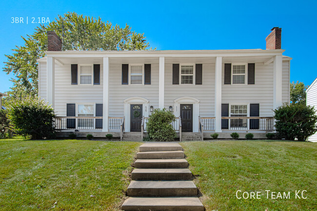
3 Bedroom - Townhome for Rent
- 3BR, 2.5BA Townhome
- $2,895 Pricing
- 1,650 Square Feet
- Available Now Availability
Unit Rent and Fees
Unit Price
- $2,895
Price shown is base rent. Excludes user-selected optional fees and variable or usage-based fees and required charges due at or prior to move-in or at move-out. View Fees and Policies for details. Price, availability, fees, and any applicable rent special are subject to change without notice.
Property Contact Info
- Listed by:
- Agency:
- Vendor Logo:
- Website:
- View Property Website
- Call Us:
- (816) 533-7900
- Disclaimer:
Fees and Policies
Pet Policy and Fees
Cats
AllowedDogs
AllowedParking Info and Fees
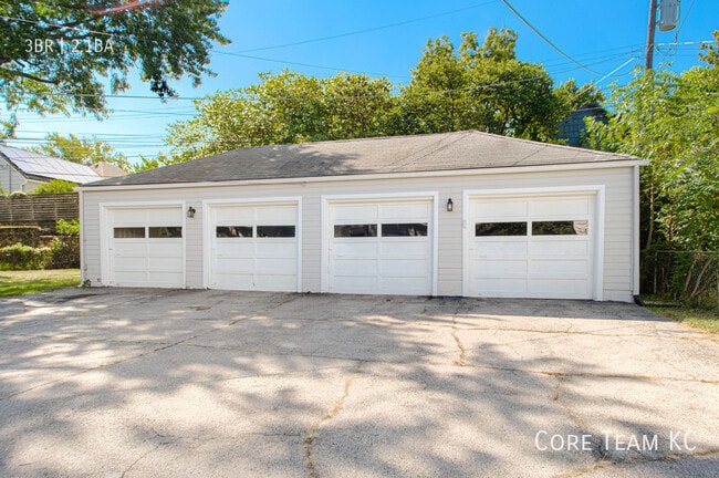
- Garage Parking
- Other
Property Fee Disclaimer: Based on community-supplied data and independent market research. Subject to change without notice. May exclude fees for mandatory or optional services and usage-based utilities.
Features and Amenities
Unique Amenities
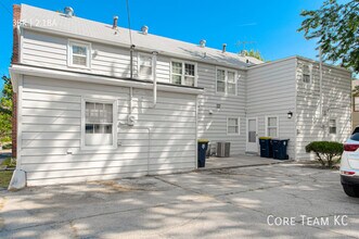
- SharedYard
Interior Features
- Fireplace
- Washer/Dryer Hookup
- Air Conditioning
Kitchen Amenities
- Dishwasher
- Microwave
- Refrigerator
- Disposal
Unique Amenities
- Garage Available
Map
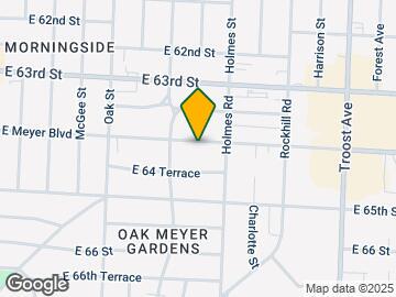
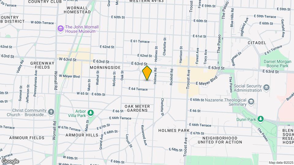
629 E Meyer Blvd, Kansas City, MO 64131
- Shopping
- Colleges
- Grocery
- Medical
- Parks
Map
Frequently Asked Questions about 629 E Meyer Blvd
What type of rental is available at 629 E Meyer Blvd?
There is currently a 3 Bed 2 Bath Townhome for rent with 1,650 sq ft listed at 629 E Meyer Blvd. It is Available Now.
How much is the rent at 629 E Meyer Blvd?
The rental at 629 E Meyer Blvd is currently listed at $2,895.
What area of town is 629 E Meyer Blvd located in?
Located in the Oak Meyer Gardens Neighborhood, 629 E Meyer Blvd is in the 64131 Zip Code of Kansas City, MO.
Nearby Schools
Central Middle School
Kansas City 33 School District
3611 EAST LINWOOD
Public School - Grades 6-8 (375 Students)
SOUTHEAST High School
Kansas City 33 School District
3500 E MEYER BLVD
Public School - Grades 9-12 (498 Students)
Hale Cook Elementary
Kansas City 33 School District
7302 Pennsylvania Avenue
Public School - Grades PK-5 (344 Students)
School data provided by GreatSchools.
details
The GreatSchools Rating helps parents compare schools within a state based on a variety of school quality indicators and provides a helpful picture of how effectively each school serves all of its students. Ratings are on scale of 1 (below average) and to 10 (above average) and can include test scores, college readiness, academic progress, advanced courses, equity, discipline and attendance data. We also advise parents to visit schools, consider other information on school performance and programs, and consider needs as part of the school selection process.
About GreatSchools Data on ApartmentHomeLiving.com.
About GreatSchools Data on ApartmentHomeLiving.com.
Points of Interest
Time and distance from 629 E Meyer Blvd.
Arts Museums and Landmarks
Big Box and Retail
Aldi
7511 Wornall Rd
4 minute drive / 1.45 miles away
Walgreens
7500 Wornall Rd
4 minute drive / 1.48 miles away
Target
8509 State Line Rd
6 minute drive / 3.03 miles away
Colleges and Universities
Groceries
Price Chopper
6327 Brookside Plz
1 minute drive / 0.6 miles away
Aldi
7511 Wornall Rd
4 minute drive / 1.45 miles away
Save-A-Lot
3410 Troost Ave
8 minute drive / 3.77 miles away
Hospitals
Research Medical Center
2316 E Meyer Blvd
3 minute drive / 1.16 miles away
St. Lukes Hospital Of Kansas City
4401 Wornall Road
5 minute drive / 2.55 miles away
University Of Kansas Hospital
4000 Cambridge Street
7 minute drive / 3.48 miles away
Parks and Recreation
629 E Meyer Blvd has 3 parks within 6.4 miles, including Theis Park, Swope Park, and Penguin Park.
Restaurants and Dining
Shopping Centers
629 E Meyer Blvd has 5 shopping centers within 0.9 miles.
Nearby Neighborhoods
Nearby Apartments
Rental Price Ranges in the Area
| Bedroom | Average Rent | Cheapest Rent | Highest Rent |
|---|---|---|---|
| Kansas City Studio Apartments | $1,267 | $525 | $10,000+ |
| Kansas City 1 Bedroom Apartments | $1,582 | $645 | $6,100 |
| Kansas City 2 Bedroom Apartments | $1,872 | $625 | $9,154 |
| Kansas City 3 Bedroom Apartments | $2,149 | $898 | $10,000+ |
| Kansas City 4 Bedroom Apartments | $2,838 | $1,430 | $3,659 |
| Kansas City 5 Bedroom Apartments | $3,950 | $3,950 | $3,950 |
Browse Top Apartments in Kansas City
By Price
- Cheap Kansas City Apartments
- Kansas City Apartments Under $600
- Kansas City Apartments Under $700
- Kansas City Apartments Under $800
- Kansas City Apartments Under $900
- Kansas City Apartments Under $1000
- Kansas City Apartments Under $1200
- Kansas City Apartments Under $1500
- Kansas City Apartments Under $2000
- Kansas City Luxury Apartments
By Community Type
- Kansas City Apartments for Rent by Owner
- Kansas City Apartments with Rent Specials
- Kansas City Top Rated Apartments
- Kansas City Corporate Apartments
- Kansas City Furnished Apartments
- Kansas City Gated Apartments
- Kansas City Loft Apartments
- Kansas City Low Income Apartments
- Kansas City Military Apartments
- New Kansas City Apartments
- Kansas City Senior Apartments
- Kansas City Short-term Apartments
- Kansas City Student Apartments
- Kansas City Apartments with Utilities Included
Viewing: 629 E Meyer Blvd | Desktop Version | Listing Updated: 07/10/2026